Mining is so deeply rooted in the Brazilian State of Minas Gerais, that it runs in the blood of almost every single citizen – including my own.
The smell of burned iron is familiar and oddly comforting. For years my life revolved around a family iron ore processing plant. Ironically, my grandmother, my mother and I suffer from a genetic disease that prevents the processing of iron in our bodies.
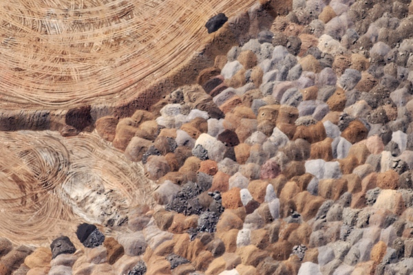
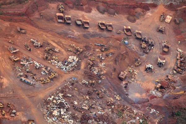
Even though mining is responsible for 15% of Brazilian gross product, it does so at the cost of environmental devastation and social disparities. A few of the numerous side effect of this activity are: semi slavery employment, high levels of prostitution, lack of water, deep air pollution, increase of temperature, deforestation etc. And, historically, I was part of that system.
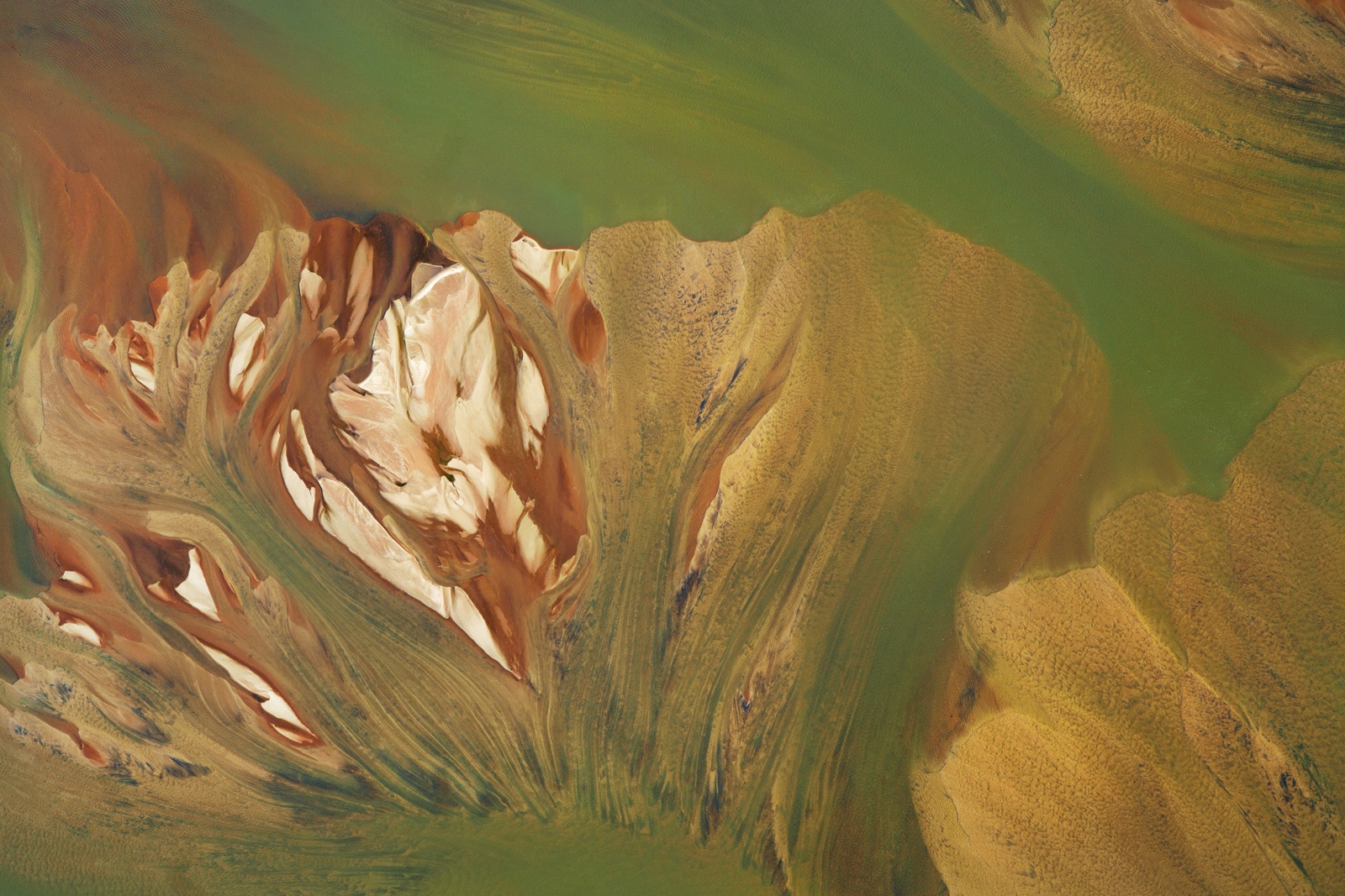
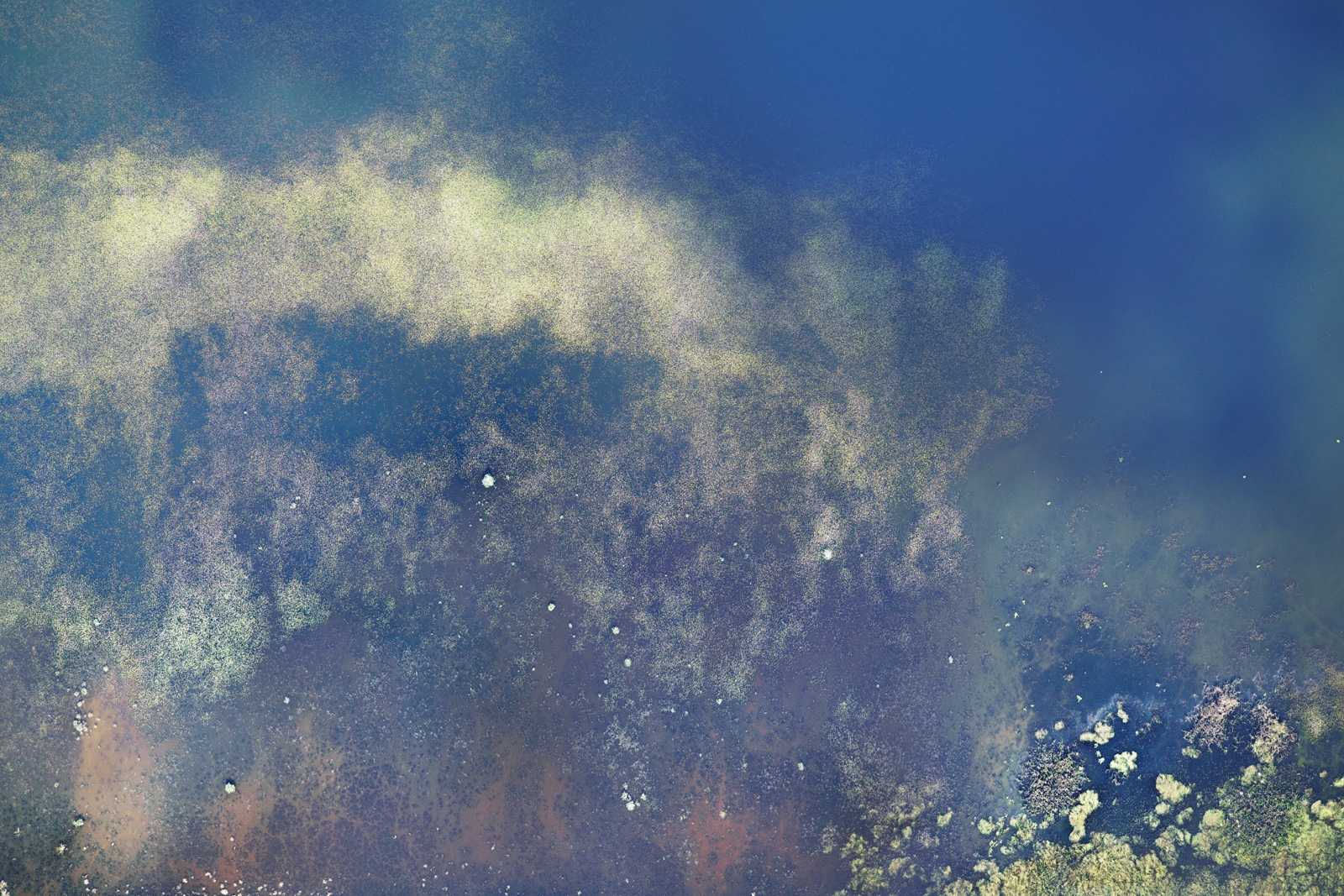
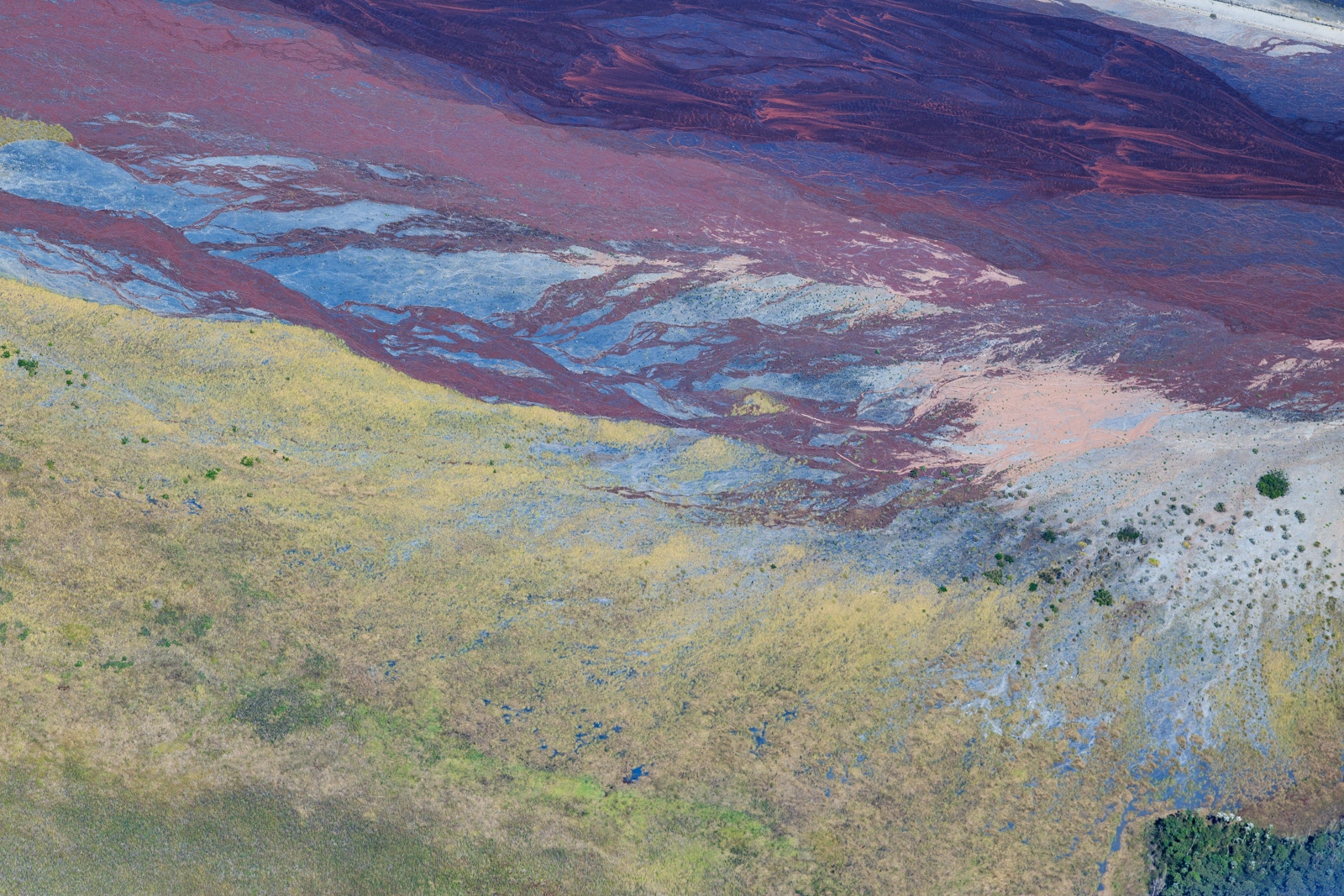
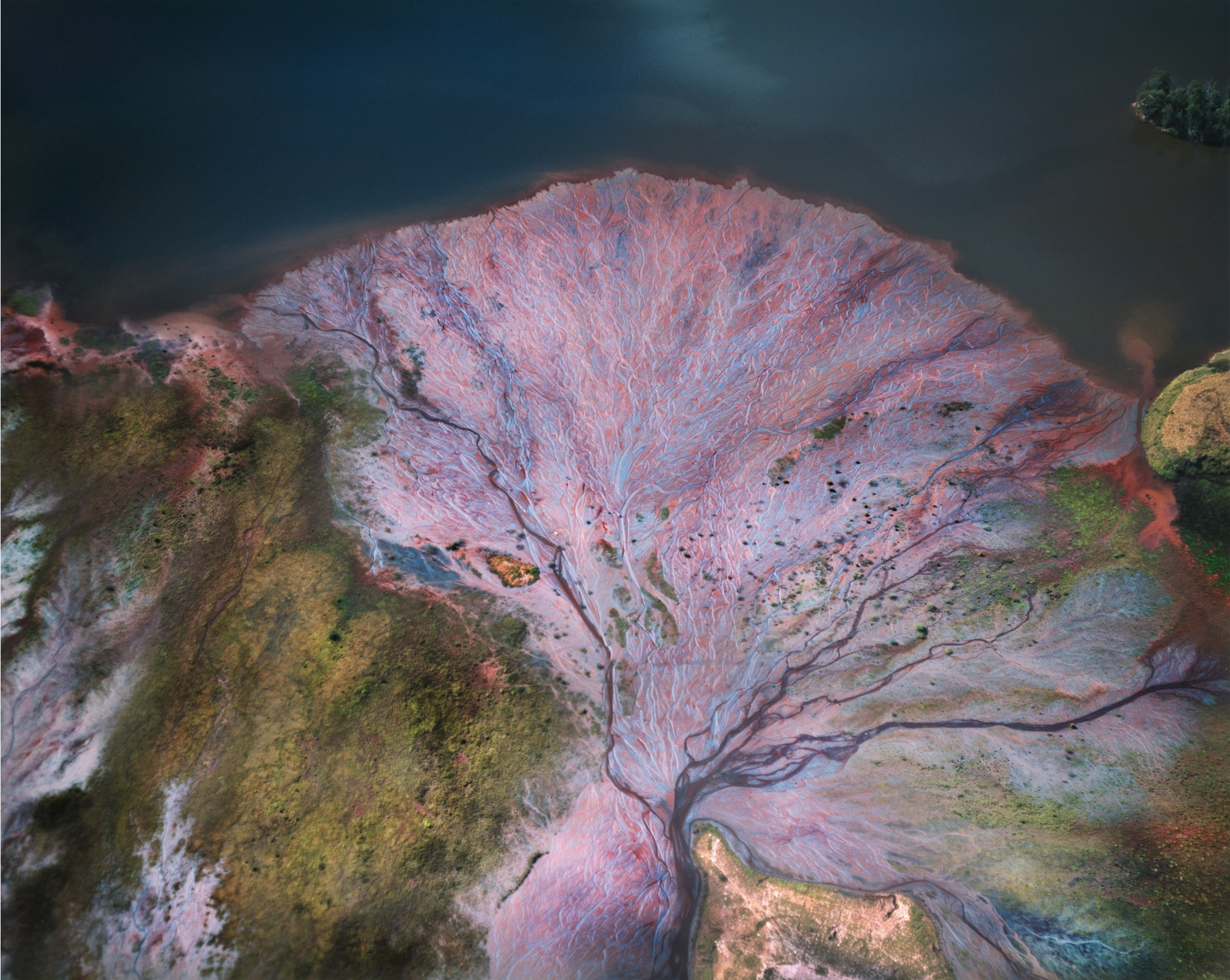
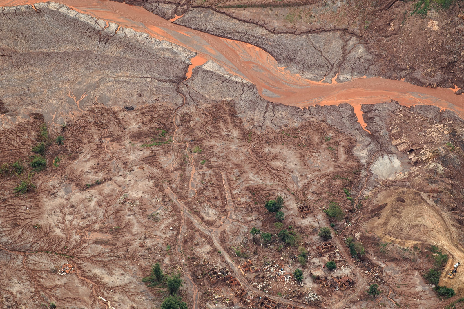
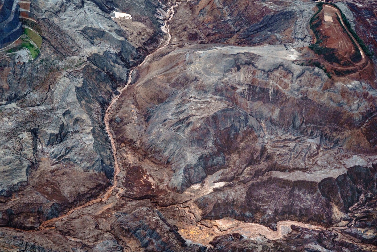
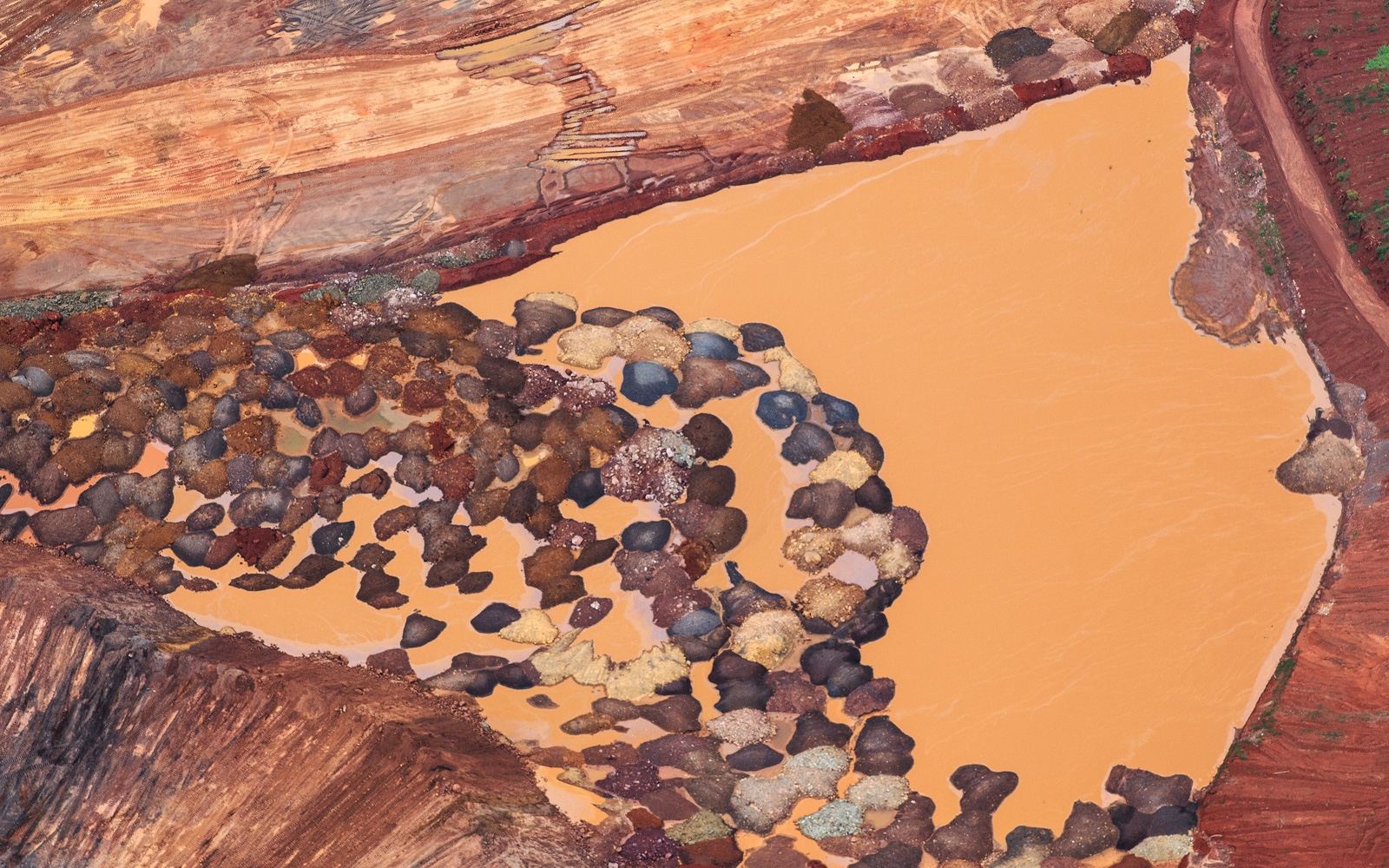
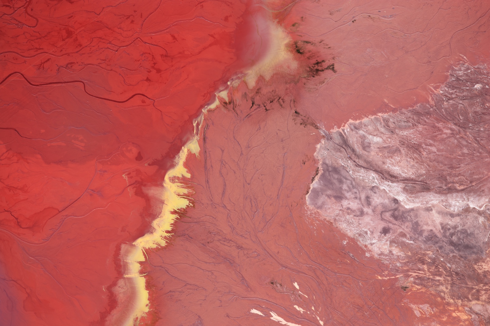
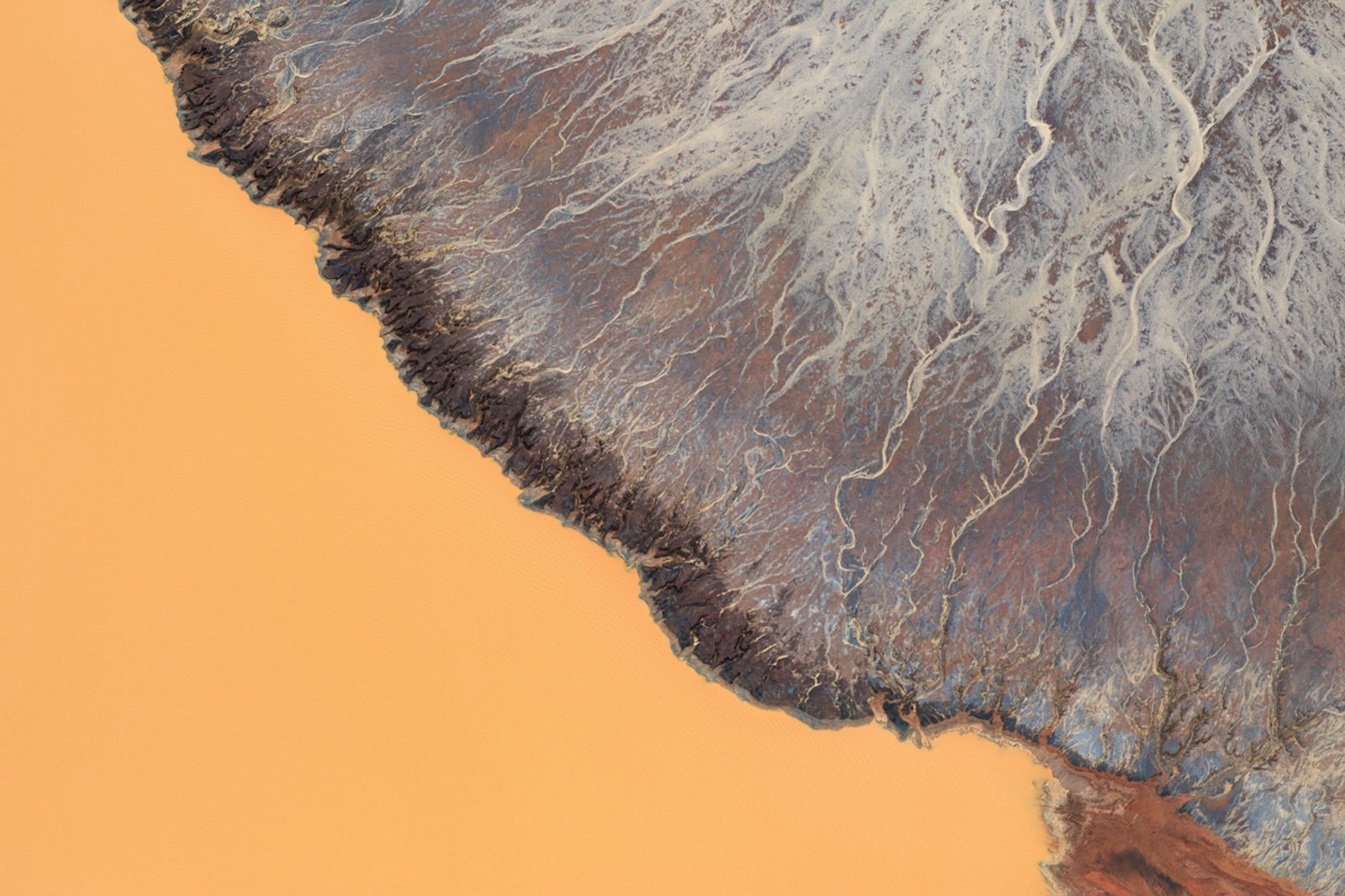
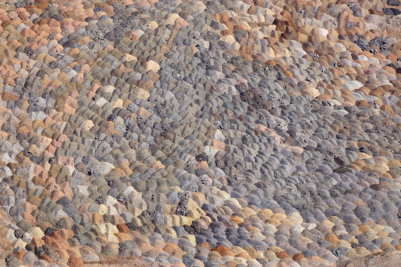
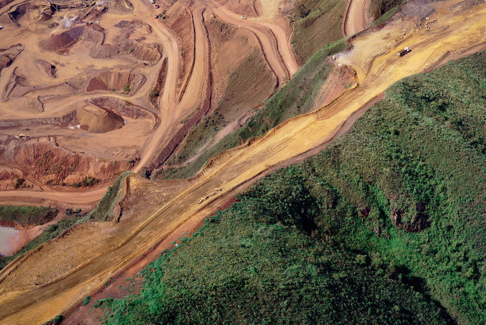
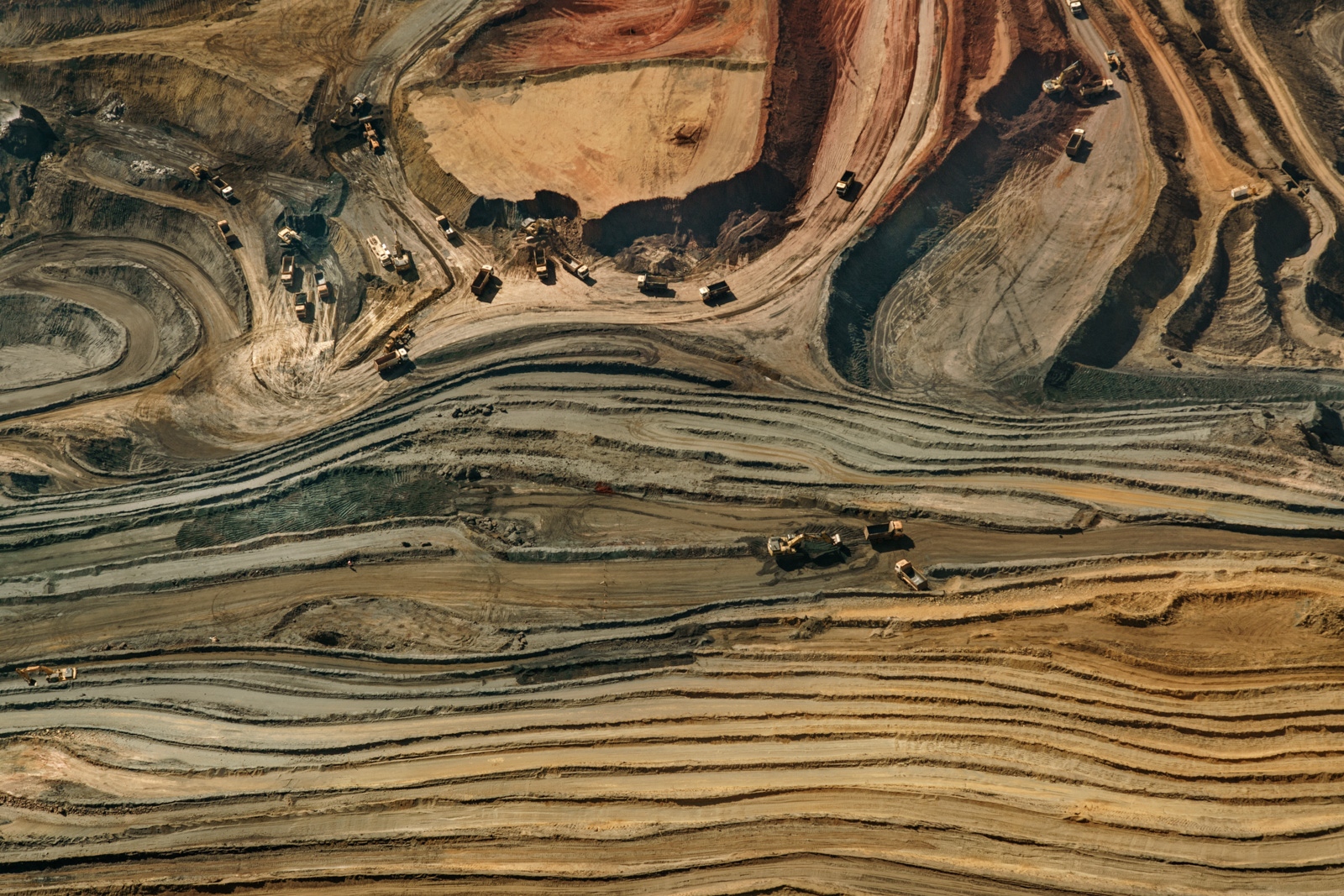
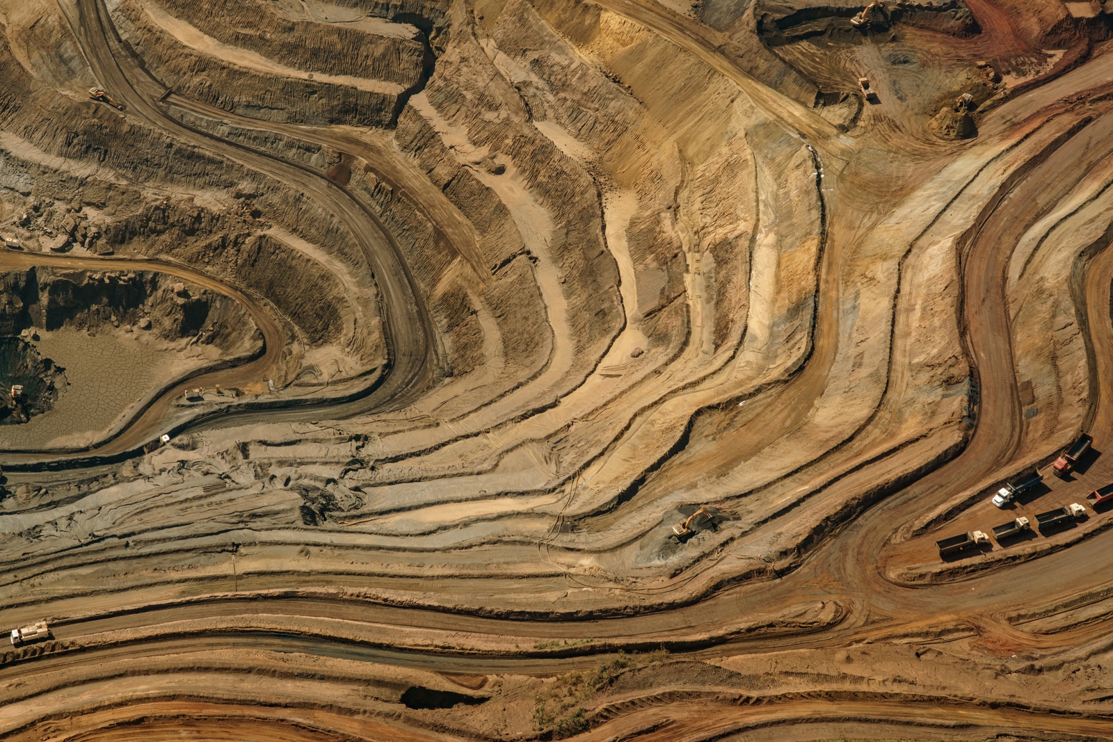
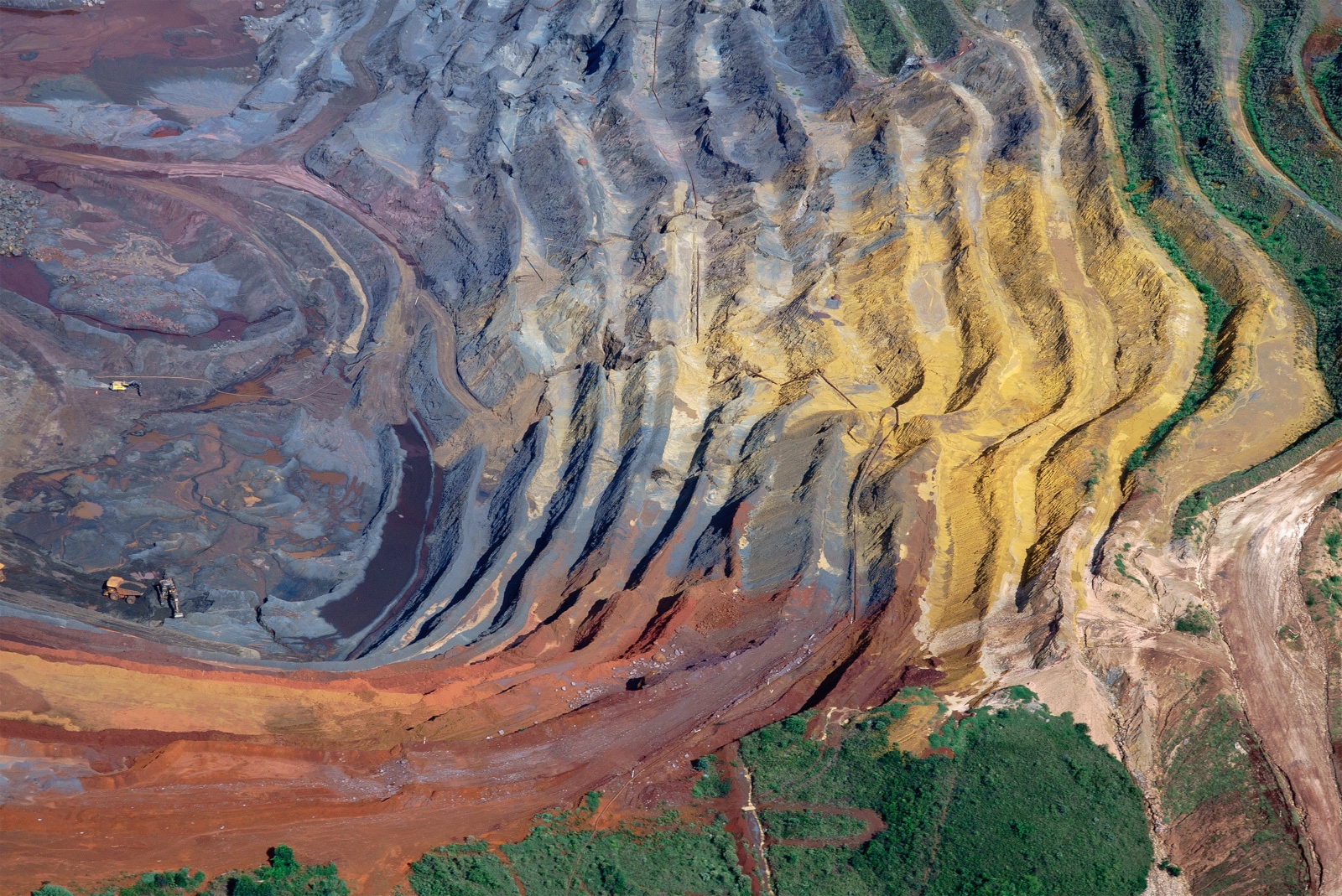
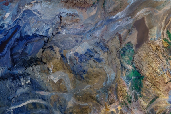
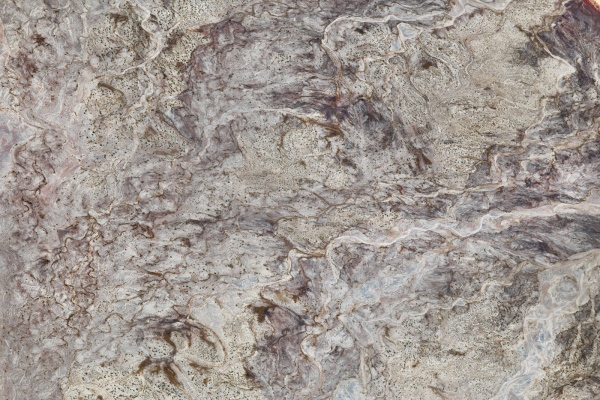
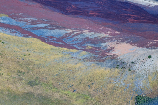
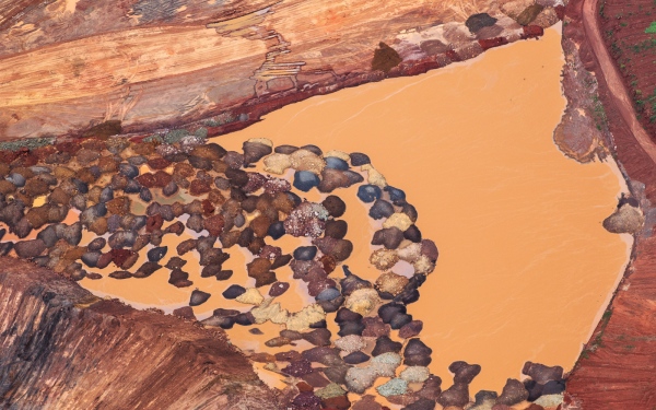
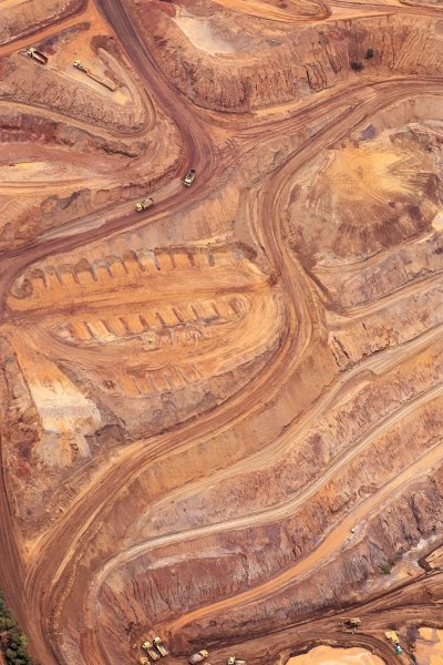
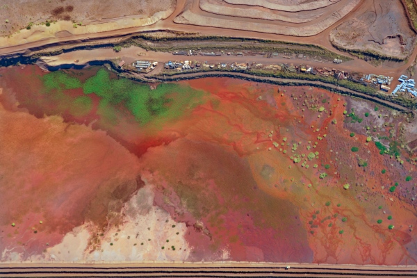
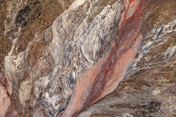
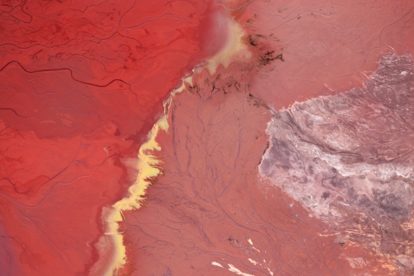
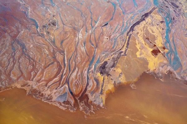
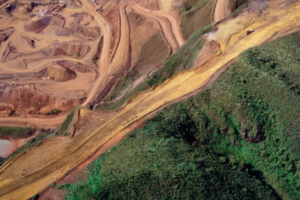
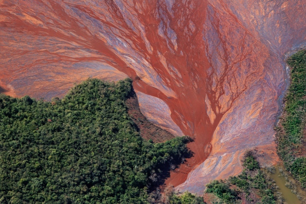
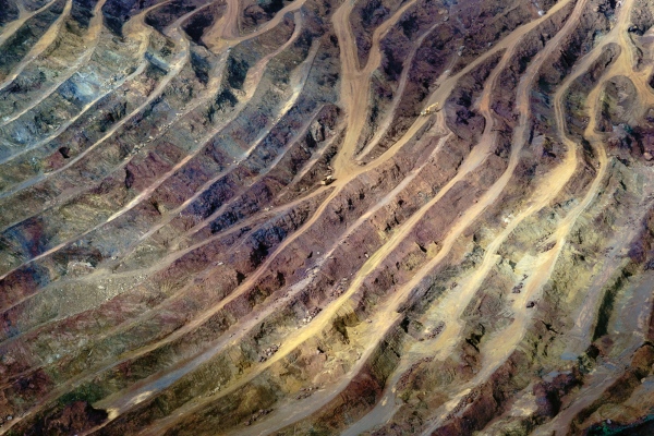
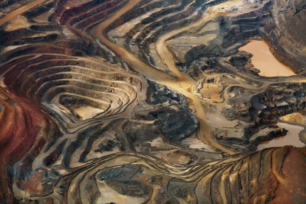
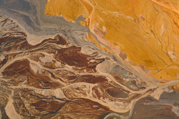
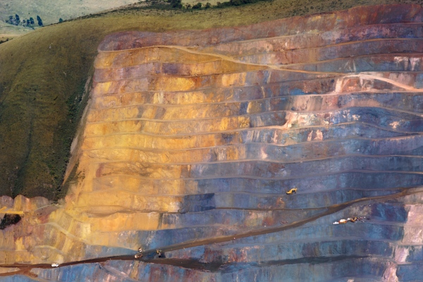
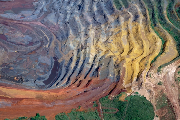
In November 2015, the collapse of a mining tailings’ dam caused the largest environmental disaster in the country’s history. 10.5 billion gallons of mud It overwhelmed smalls towns and one of the country’s most important watersheds. Since then, mining became the core of my practice and research. For the past 3 years I have been working on a project about mining - focused in Brazil. There, the intensive mining activity has resulted in a radically changed - and decaying - landscape.
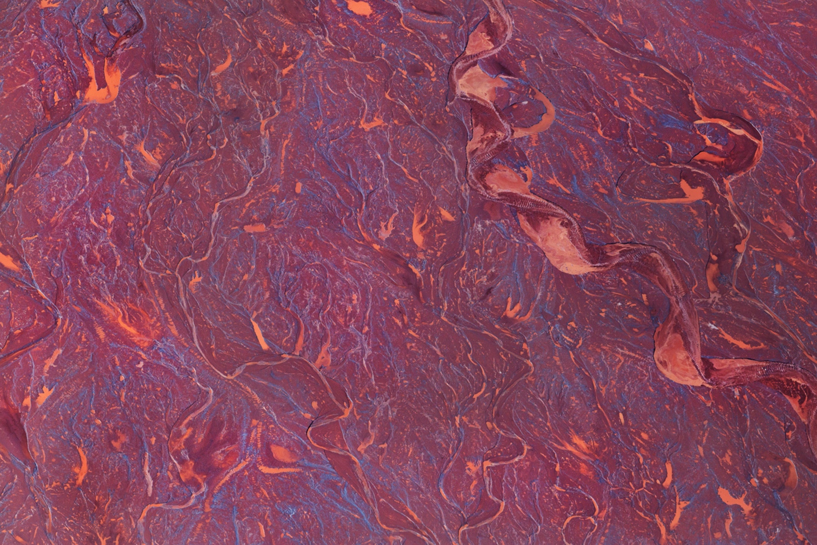
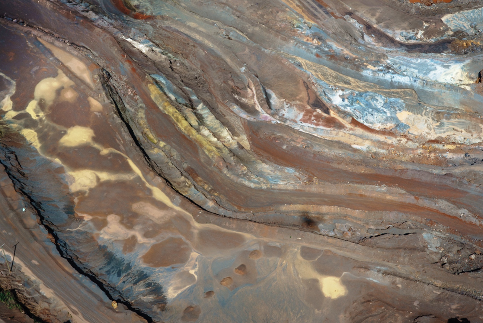
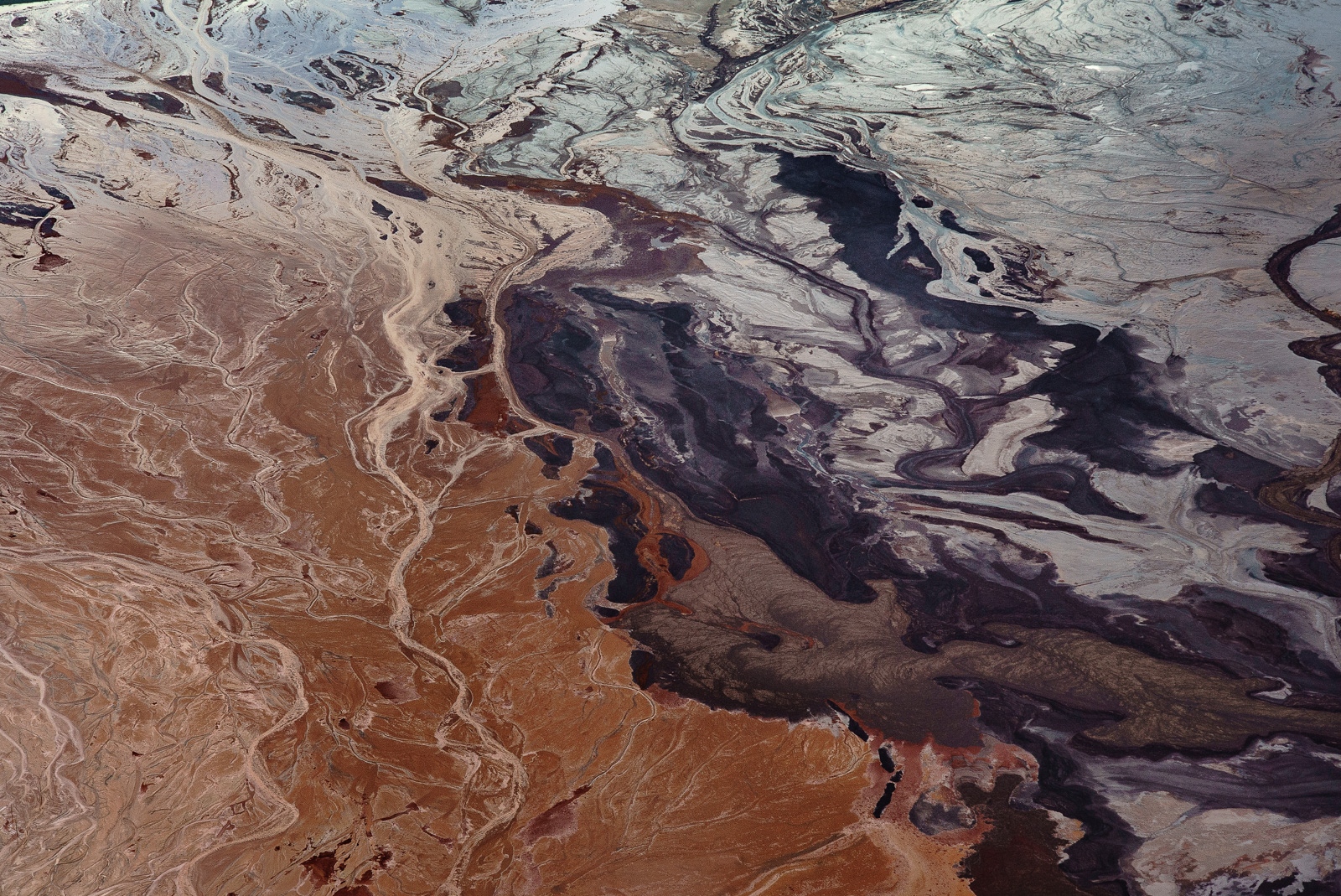
The full extent of the human and environmental devastation caused by this accident, and by open pit mines more generally, are obscured by the region’s mountainous terrain, relatively inaccessible to the local population. Working in collaboration with a pilot, I have been photographing from above, sometimes flying in forbidden air space.
Mining also shaped the identity and the challenges faced by local society. I wanted to explore and investigate the emotional relationship between the man and the land so I expanded my investigation to the ground and have been traveling by myself through the regions I had flown above.
Also, the Amazon rainforest is hugely compromised by mining. Currently, 10% of the Brazilian soil is under a concession for one of the hundreds of mining related companies operating there. Many mining towns have already reached -and surpassed - the 2 degree celcius temperature increase, the global agreement.
Every day we are surrounded by metallic components. The computer and the keyboard which I am typing this proposal are part of that chain. o produce a car an average of 4,200 pounds of iron ore is needed. Demand and source urgently need to come to a balance, once the damage is done, there is no way back.
If the land is a body, mining exploration is a violent act of penetration. The new matter is conquered by a constant extirpation where the subject is defenseless.
*ongoing project
Ó Minas Gerais | My Land Our Landscape #23
Dry Season
Linhares, close to Regência, state of Espírito Santo. Where Rio Doce river/water shed meets the sea.
Approximately 400 miles from the accident site following the river course. 9 months after the environmental accident.
Ó Minas Gerais | My Land Our Landscape #6
Wet season.
Photograph taken at Serra Três Irmãos, Minas Gerais. Located in the limits of Brumadinho. Most cities, as this one, where mining companies are the main source of employment, population is afraid of speaking up and telling the health issues and other problems caused by mining. They are afraid of loosing their jobs or to risk the company to relocate their business to other areas. So far unable to identify the kind of mineral being extracted.
Ó Minas Gerais | My Land Our Landscape #21
Dry season.
Rio do Peixe, Minas Gerais. City of Itabira, Minas Gerais.
Close to the city of Itabira. Mining activities consume an immense amount of water due the metal separation process. Itabira, originally a resourceful city in terms of water has been suffering with the
draught of Rio do Peixe because of the intensive exploration that has carved all the surrounding landscape.
Ó Minas Gerais | My Land Our Landscape #22
Dry season.
Itabira, Minas Gerais.
Tailing dam of an Iron Ore Mine. Itabira is the hometown of Carlos Drummond de Andrade, one of Brazil
most important poets. He refused to go back to his home town after its largest natural symbol was
destroyed by a mining company.
Ó Minas Gerais | My Land Our Landscape #30
Dry season.
Itabira, Minas Gerais.
Mud and weed in a tailing dam.
Ó Minas Gerais | My Land Our Landscape #29
Dry season.
Itabira, Minas Gerais.
Large Format Positive Film.
Speed Graphic camera adapted for aerial photography with the help of 2 members of the mining community.
Ó Minas Gerais | My Land Our Landscape #24
Dry season.
Chapada/Rio do Peixe. City of Itabira, Minas Gerais.
A clear example of the different shapes and forms the same river can have when turned into a tailing dam.
Ó Minas Gerais | My Land Our Landscape #2
Wet season.
Photograph taken at Serra Três Irmãos, Minas Gerais.
So far unable to identify the kind of mineral being extracted.
Ó Minas Gerais | My Land Our Landscape #1
Wet season.
City of Mariana, Minas Gerais. Bento Rodrigues’s town, 3 months after the mining accident.
After the accident there was 900% increment of Dengue cases and a deep increase on respiratory diseases among children in the region along the Doce River.
Ó Minas Gerais | My Land Our Landscape #5
Wet season.
Dry season in Brazil.
Photograph taken close to Itauna, Minas Gerais.
Tailing dam of an Iron Ore Mine.
Ó Minas Gerais | My Land Our Landscape #4 (ex 6)
Wet season.
Course of the Doce river through the mountains. The mineral waste released by the accident reached the height of 4 meters, dragging trees, houses and people.
Ó Minas Gerais | My Land Our Landscape #19
Wet Season.
20 ° 30'1.379 "S 43 ° 54'53.807" W
Congonhas | World Heritage Site. The historical town has the one of the most relevant barroque art collection in Brazil. The cultural sites, as well as the populated areas, are located directly below a tailings’s dam. First house is located 200mts above the dam. In a case of breakage it would reach them in a matter of seconds.
The dam was in a great risk of breaking in 2017.
Ó Minas Gerais | My Land Our Landscape #18
Wet season.
Each truck is approximately 24ft tall, 30ft wide and 50ft long. (7.5 m tall, 9.5 mt wide and 15mt long).
That’s as high as a 3 storey building.
Ó Minas Gerais | My Land Our Landscape #36
Dry season.
Itabira, Minas Gerais.
Borders of a Tailing dam.
Ó Minas Gerais | My Land Our Landscape #26
Dry Season.
City of Mariana, Minas Gerais Fundão’ tailing Dam 9 months after it broke generating the largest environmental accident in the history of Brazil.
Ó Minas Gerais | My Land Our Landscape #37
Dry season.
Quadrilátero Ferrífero, Minas Gerais.
Tailing Dam.
Ó Minas Gerais | My Land Our Landscape #8
Wet Season,
City of Mariana, Minas Gerais Fundão’ tailing dam 60 days after it broke generating the largest environmental accident in the history of Brazil.
Ó Minas Gerais | My Land Our Landscape #9
Wet season
The sediments and water interacting at a tailing dam.
Photograph taken at Quadrilatero Ferrifero, region that used to be on of the largest iron ore reservoirs in the world. Almost all the top quality iron is gone now, leaving the low quality iron for exploration that requires even more digging and landscape damage.
Ó Minas Gerais | My Land Our Landscape #32
Dry season.
Quadrilátero Ferrífero, Minas Gerais.
Iron ore quality sorting.
Ó Minas Gerais | My Land Our Landscape #31
Dry season.
Quadrilátero ferrífero, Minas Gerais.
Ore quality sorting. Each little pile can be as tall as tall as 30ft.
Ó Minas Gerais | My Land Our Landscape #2
Wet season.
Congonhas, Minas Gerais.
Patio with mining debris.
Ó Minas Gerais | My Land Our Landscape #10
Wet season.
Quadrilátero Ferrífero, Minas Gerais.
The state’s public attorney usually make agreements to keep the visible side of the mountain untouched.
Ó Minas Gerais | My Land Our Landscape #28
Dry Season
São Gonçalo do Rio Abaixo, Minas Gerais.
19 ° 52'36.33 "S 43 ° 24'12.311" W In the 2010 census the city had the 6th highest GDP in Brazil.
Ó Minas Gerais | My Land Our Landscape #14
Wet season.
Quadrilátero Ferrífero, Minas Gerais.
Scale: truck occupies approximately 1,500 square feet.
Ó Minas Gerais | My Land Our Landscape #25
Dry Season
Located in the Ferrifero Quadrilatero, reference point of the internalization of Portuguese occupation in Brazil in the 18th century.
Ó Minas Gerais | My Land Our Landscape #12
Dry season.
Photograph taken at Serra da Moeda, Minas Gerais.
Iron Ore Mine in activity.
Ó Minas Gerais | My Land Our Landscape #33
Dry season.
Quadrilátero Ferrífero, Minas Gerais.
Iron ore pit.
Ó Minas Gerais | My Land Our Landscape #34
Dry season.
Quadrilátero Ferrífero, Minas Gerais.
Tailing dam.
Ó Minas Gerais | My Land Our Landscape #35
Dry season.
Quadrilátero Ferrífero, Minas Gerais.
Since the visible side of the mountain remains intact, many mines are not seen by highways close by. Most times the population have no idea how deep the pits are. When visible, mining companies keep fences covered by tall trees or other types of coverage.
Ó Minas Gerais | My Land Our Landscape #16
Wet season.
Quadrilátero Ferrífero, Minas Gerais.
Land refilling is not mandatory in Brazil, when the exploration is over, grass is planted to avoid land erosion.
Júlia Pontés
Júlia Pontés (b.1983 - Minas Gerais, Brazil) - Based in Sao Paulo, New York, and Buenos Aires. She is a skilled drone pilot, aerial photographer, photographic printer and her photographic knowledge range from Large Format Film photography to advanced Photoshop skills.